
Dry Falls
Highlands, NC
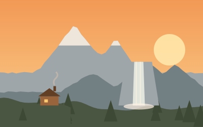
A 65-foot waterfall on the Cullasaja River with a paved path and steps that lead behind the curtain of water. National Forest day-use fee; the small lot fills on summer weekends and October color days.
- Nearest town
- Highlands, NC
- Category
- Nature & parks
- GPS
- 35.0687, -83.2387
- Editor's pick
- ★
Hours, fees and access change. Confirm with the operator or park before you go.
Good to know
Best time to go
The most pleasant months are usually May–June and September. Still fine, with some compromises, in April, July–August and October. Cold, short days in January. (Estimate from long-term temperature averages, terrain and pass seasons)
Featured in these trip guides

Nearby




Campsites nearby
- Gorges State Park CampgroundCampsite17 mi from Dry FallsTentsCaravansDrinking waterShowersToilets
- Winding Stair CampgroundCampsite17 mi from Dry Falls
- Chattooga River Lodge and CampgroundCampsite20 mi from Dry FallsShowersToilets
- Backcountry Campsite #2Campsite24 mi from Dry Falls
- Backcountry Campsite #3Campsite24 mi from Dry Falls
- Terrora CampgroundCampsite24 mi from Dry Falls
All campsites in North Carolina · Campsite data: © OpenStreetMap contributors, ODbL 1.0 · Updated October 3, 2026
FAQs
Where is Dry Falls?
Dry Falls is in Highlands, NC, at GPS 35.0687, -83.2387. It is about 8 mi from Cashiers.
Can you camp near Dry Falls?
Yes. The nearest campsite listed in OpenStreetMap is Van Hook Glade Campground, about 1 mi away; within 25 mi there are 38 campsites and motorhome stopovers.
Which road trips pass Dry Falls?
Dry Falls is a stop on these CampingSpirit trip guides: The Waterfall Byway: Brevard to Highlands and Franklin.
What is there to see near Dry Falls?
Places worth a stop nearby: Bridal Veil Falls (1 mi), Whiteside Mountain (5 mi), Whitewater Falls (13 mi) and Lake Jocassee, Devils Fork State Park (18 mi).
When is the best time to visit Dry Falls?
The most pleasant months are usually May–June and September. Still fine, with some compromises, in April, July–August and October. (Estimate from long-term temperature averages, terrain and pass seasons)