Alaska’s Seward Highway
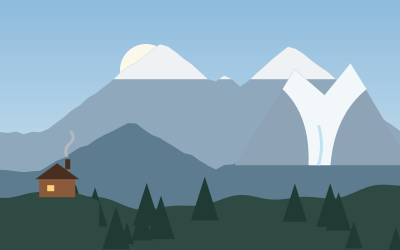
Turnagain Arm, Girdwood and a glacier you can walk to, on the way to Resurrection Bay.
- Distance
- 190 km (118 mi)
- Driving
- 2 h 07 min
- Suggested days
- 2
- Stops
- 4
- States
- AK
- Updated
- June 12, 2026
At a glance: 2-day road trip of about 190 km (118 mi) with 4 stops, from Anchorage to Exit Glacier. About 2 h 07 min of driving in total.
More road trips in Alaska · More road trips from Anchorage
Route description
From Anchorage, the Seward Highway follows Turnagain Arm, a narrow inlet framed by the Chugach Mountains, one of the most scenic roads in Alaska. Stop at Beluga Point and the pullouts along the arm to look for beluga whales and, at Windy Point, Dall sheep on the cliffs above the road. With luck, you can see the bore tide, a wave that rushes in on the incoming tide.
Girdwood, a short detour inland, is a ski town with an aerial tram up Mount Alyeska and trails through the rainforest. At the end of the arm, the road passes the Alaska Wildlife Conservation Center and the turnoff for Portage Glacier and the tunnel to Whittier. The highway then climbs over Turnagain Pass and through the Kenai Mountains, past lakes and rivers, to Seward.
Seward lies at the head of Resurrection Bay, with boat tours into Kenai Fjords National Park to see tidewater glaciers, whales and seabirds, and the Alaska SeaLife Center on the waterfront. Just outside town, a road leads to Exit Glacier, where a short trail with signs showing how far the ice has retreated leads toward the glacier.
Never walk onto the mudflats of Turnagain Arm, where people can get stuck in the silt and caught by the tide. Use the pullouts to stop for wildlife, and expect heavy traffic on summer weekends. Campgrounds and boat tours in Seward fill up in July, so book ahead.
Stop-by-stop itinerary
In driving order. Distances are estimates between consecutive stops.
- 1Start
Anchorage
AK - 260 km
Girdwood
AK - 3113 km
Seward
AK - 417 km
Exit Glacier
NatureSeward, AKA glacier you can walk toward, with signs showing how far the ice has retreated.
Suggested stages and overnight stops
2 days, split by driving time. Campsites from OpenStreetMap: check opening dates before you go.
- Day 1: Anchorage → Girdwood · 37 mi · 0 h 40 min
- Day 2: Girdwood → Exit Glacier · 81 mi · 1 h 27 minOn the way: Seward.
Best time to go
No month is ideal everywhere on this route; the most pleasant are usually June–July. Cold, short days in November–April. July and August are the busiest months: book campsites early.
Estimate from long-term temperature averages, terrain and pass seasons
FAQs
How long is Alaska’s Seward Highway?
2-day road trip of about 190 km (118 mi) with 4 stops, from Anchorage to Exit Glacier. About 2 h 07 min of driving in total.
How many days do you need for Alaska’s Seward Highway?
We suggest 2 days: about 2 h 07 min of driving, which leaves time for the stops.
Where does Alaska’s Seward Highway start and end?
It starts in Anchorage and ends in Exit Glacier.
Which states does Alaska’s Seward Highway pass through?
Alaska.
When is the best time for Alaska’s Seward Highway?
No month is ideal everywhere on this route; the most pleasant are usually June–July. Cold, short days in November–April. (Estimate from long-term temperature averages, terrain and pass seasons)